Oracle Spatial Database
To insert a layer from Oracle Spatial:
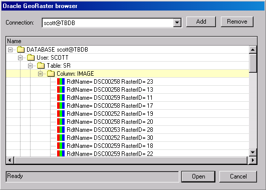
Oracle GeoRaster Browser
1. From the Connection list, select a connection.
Note: You can remove a connection from the list by selecting it and clicking Remove.
2. If you want to add a connection, click Add, and enter the parameters in the Oracle Connection Parameters dialog box. See “Adding an Oracle Connection” in this chapter for more information.
3. Select the required layer file in the files hierarchy tree. The selected layer is added to the project and displayed in the Project Tree.
Adding an Oracle Connection
To add an Oracle Server connection:
1. In the Oracle GeoRaster Browser dialog box, click Add. The Oracle Connection Parameters dialog box is displayed.
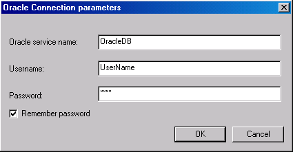
Oracle Connection Parameters Dialog Box
2. Define the following parameters:
|
Field |
Description |
|
Oracle service name |
The Net Service name |
|
User Name |
User name to access the server (mandatory) |
|
Password |
Enter the password |
|
Remember password |
Check the check box if you want the system to remember it for future use |
3. Click OK. The new connection is added to the list.