Target
The Target tool continuously tracks the distance and direction to a specific target.
To use the Target tool:
1. On the Navigation tab, in the Navigation Aid group, click Target. The Target dialog opens.
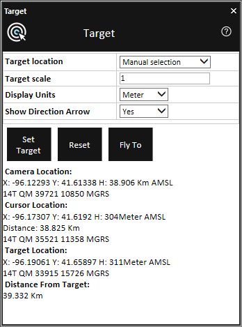
Target Dialog
2. Enter the following information:
|
Field |
Description |
|
Target Location |
Select either: § Numeric Entry § Manual Selection If you select Numeric Entry, enter the X, Y, and H values. |
|
Target Scale |
Select the type of target marking object. |
|
Display Units |
Select the display units to be used for distance/height information. |
|
Show Direction Arrow |
Select Yes if you want to display the direction-to-target arrow. |
3. Click Set Target.
4. If you are using Manual Selection as the Target-Set-Mode, click on the terrain or on any object in the 3D Window.
5. The tool displays the Camera Location, Cursor Location, Target Location and Distance from Target values according to the selected units.
6. To reset this tool, click Reset.
7. To fly to the target location, click Fly to.