Block width tool
An appropriate block width is one of the most critical parameters used to stream a layer efficiently. If the block width is too large, requesting data from the data source will take longer. If the block width is too small, TerraExplorer "wastes" many requests transmitting data it could have easily transmitted in one request. This also results in "bothering" the data source with many small requests.
The Block Width tool calculates an appropriate block width for efficient layer streaming. In some cases, setting the best block width for a layer is an iterative process. Two major factors influence the selection of the block width for a layer:
§ Layer’s Maximum Visibility Distance – The higher you want to view the data, the bigger the block width should be.
§ Density and Precision Level - The denser and precise the data, i.e., the mean points or vertices per area, the smaller the block width should be.
Sometimes, although the data is very dense and precise, you might want to view it from a high visibility distance. In this situation, it is advised to simplify the layer.
Using the block width tool
To use the Block Width tool:
1. On the Tools tab, in the Calculate group, click Block Width. The Block Width dialog is displayed.
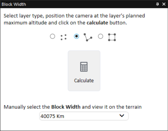
Block Width Tool
2. Select the layer’s type: point, polyline or polygon.
3. Position the camera at the layer's planned maximum altitude
4. Click Calculate.
OR
From the dropdown list, manually select the Block Width dimensions and view it on the terrain.