Working with feature layers
A feature layer represents a geographic dataset such as roads, rivers, national parks, or political boundaries, using geographic objects (features) including points, lines, and polygons. When a feature layer is loaded, TerraExplorer creates a layer object in the Project Tree that contains all features in the dataset. This layer object enables layer-level operations, allowing you to control the appearance and behavior of all features through a single property sheet. Because features in a layer share the same properties (except for position), feature layers are efficient and result in lighter project files.
Feature Representation and Visualization
You can define how features are displayed by selecting a symbol type for rendering. In addition, TerraExplorer Pro can create an annotation object at the center of each feature, enabling you to present related information visually or textually.
Most feature layers contain a homogeneous geometry type (all points, all lines, or all polygons). However, some DGN and DXF formats may include multiple geometry types within a single layer.
TerraExplorer also supports multi-part geometries:
§ Multi-polygons and multi-lines are loaded as-is
§ Multi-point features are automatically converted into single-point features with duplicated attributes
Working with Attributes and Data
Feature layers often include attribute data describing each feature. This data can be used to drive visualization and analysis. For example, you can symbolize features based on attribute values (e.g., display country borders using colors based on population). Or you can filter features to display only those matching specific criteria (e.g., countries with GNP per capita above $15,000).
The Attribute Table Tool allows you to:
§ Search and filter feature data
§ Display only selected features in the 3D Window
§ Create a new layer from filtered results (without modifying the original layer)
Spatial Operations and Analysis
When a feature layer is selected, the Feature Layer contextual tab provides access to a range of spatial operations, including:
§ Merging multiple features into one
§ Clipping polygons
§ Exploding multi-part features into individual components
§ Exporting selected features to a new file
Data Sources and Editing
TerraExplorer Pro supports loading feature layers from both local and remote data sources, including databases and files accessed via plug-ins. Because the layer maintains a connection to its source, you can refresh the layer to retrieve the latest updates.
For certain formats, edits can be written back to the source:
§ Shapefiles
§ File GeoDatabase files
§ KML/KMZ files created by TerraExplorer
§ WFS-T (transaction-enabled WFS services)
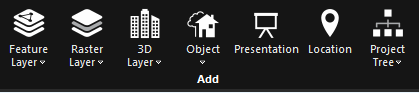
Home Tab Add Group