TerraExplorer and our Photo Inspector extension
command & control and asset tracking
with an intelligent, high-impact digital twin
Optimize Your Geospatial Data
Skyline provides the platform needed to process, build, analyze, save, and share your 3D/2D geospatial data
Fully-automated, scalable photogrammetry. 3D reconstruction that transforms photos into quality, 2D and 3D geospatial data

Solutions
How Can We Help You?
3D depth analysis opens a whole new world of insight and intelligence to any business, whether mapping, planning, public safety or construction. Depth information contributes to volume, shade, line of sight, flooding, building planning and much more. Save time and money by getting the right answers faster with 3D.
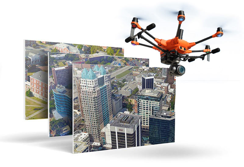
First step is to pick your collection, processing, and analytics platforms. There are several collection options, including manned aerial imagery aircraft, fixed wing drones, and quadcopter drones. The decision depends on the size of the area for which you want to capture imagery and the level of detail you require. Airplanes can rapidly collect imagery data for entire cities but with a moderate level of detail. Fixed wing drones provide more detail but collection takes longer. Quadcopter drones are generally used for extremely detailed close-range inspection of small areas. Using ground control points or RTK systems improve your GIS accuracy. Skyline provides all the tools to process, visualize, and analyze your collected imagery.
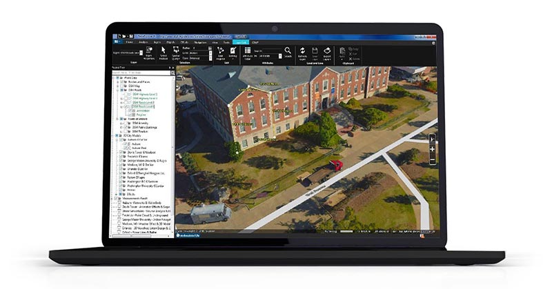
Skyline provides state of the art modeling, analytics, and visualization software to produce highly accurate and visually stunning 2D and 3D products. These products include 3D Mesh, Point Clouds, True Orthomosaics, DSM, and DTM in multiple formats for wide compatibility in many applications. Skyline’s desktop software offers a vast array of advanced visualization options and analytical tools so you can get the most information possible out of your imagery and LiDAR collections.