Setting the Terrain Database
You can set the MPT or .FLY to use as the base terrain for your project.
To set the terrain database:
1. On the Home tab, in the Add group, click Terrain Database. The Terrain Database dialog is displayed.
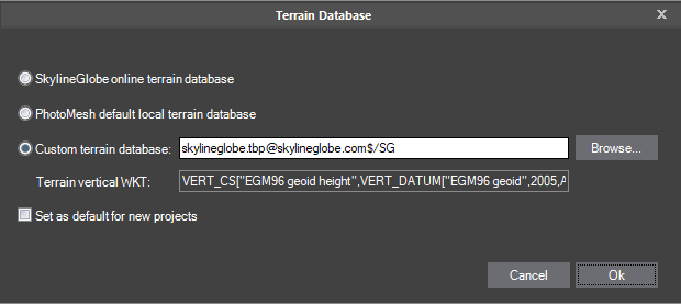
Terrain Database Dialog
2. Select one of the terrain database options:
§ SkylineGlobe online terrain database – To use the default terrain database ([email protected]).
§ PhotoMesh default local terrain database – To use the base terrain file included with the PhotoMesh installation (Default_Local_Terrain.mpt).
§ Custom terrain database – To use a custom terrain database. Browse to the required file.
3. If you want to set your selected option as the default for new projects, select the check box. The default terrain database for new projects is listed in the PhotoMesh Options dialog. See "Setting PhotoMesh Options" in the "Basic Concepts" chapter for more information.
4. Click OK.