Reduce risk, increase efficiency, and improve quality with Skyline’s virtual inspection solutions
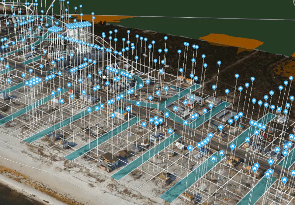
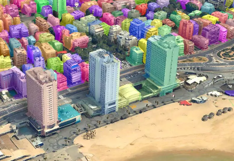
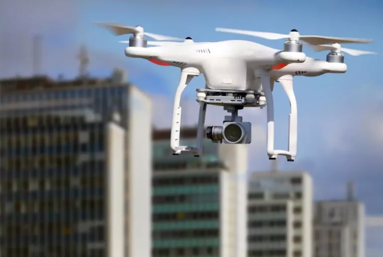
Stay ahead of the competition by incorporating Skyline’s cutting-edge technology into your inspection services. Our PhotoMesh software eliminates the need for manual inspections by utilizing drone photography to capture the site. PhotoMesh’s fully automated, scalable modeling capabilities then convert these images into high-resolution, textured 3D mesh models with sub-millimeter accuracy. These models can be viewed and queried in TerraExplorer, providing a safe and efficient way to perform inspections. PhotoMesh offers exceptional 3D model generation turnaround time of just 1-2 hours for a typical 2000-photo drone collection. This is achieved through its use of cluster computing per model.
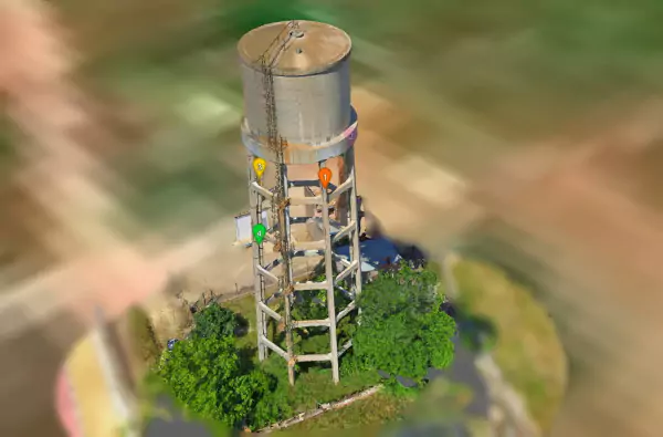
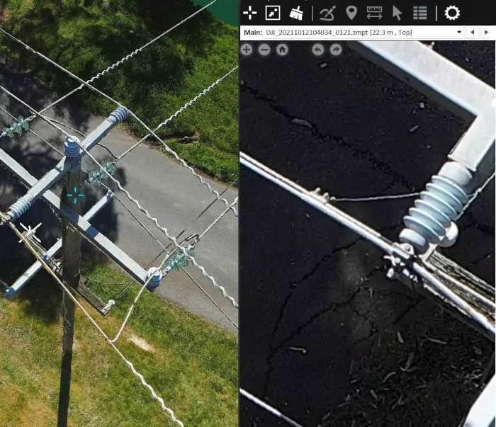
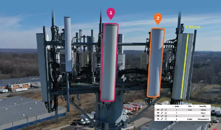
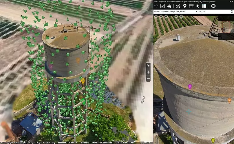
Take your inspection services to the next level with TerraExplorer’s Photo Inspector tool. Provide your clients with a safe and efficient way to perform inspections and increase the speed and accuracy of identifying potential issues. The tool’s ability to mark up, annotate, and generate detailed reports from the 3D model streamlines the inspection process and enhances transparency and collaboration among team members and stakeholders.
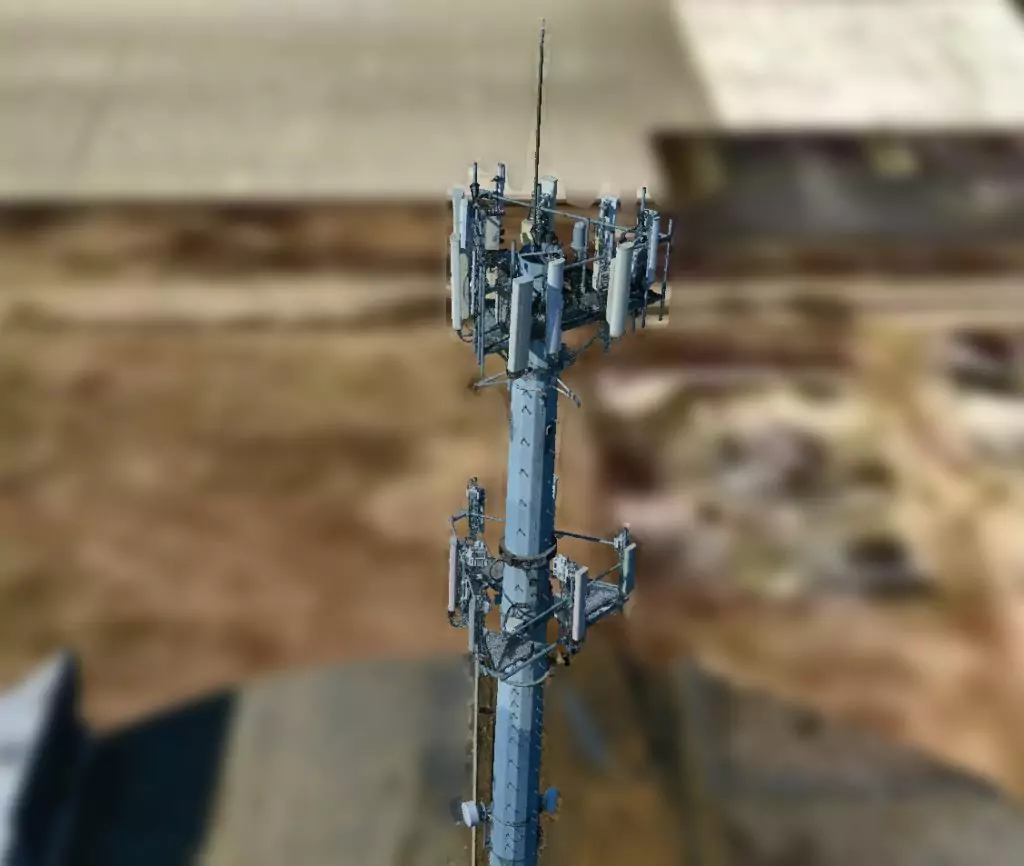
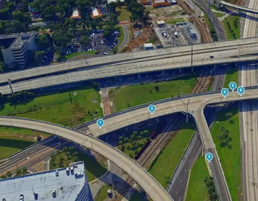
Use TerraExplorer’s powerful tools and high-resolution 3D environment to analyze the model, reducing the need for physical site visits. Take measurements to assess the structural integrity of a bridge or inspect the condition of a railroad track with ease. Use TerraExplorer’s comparison tool to identify any deviations from the design that could impact safety and operations.
Take your inspection services to the next level with TerraExplorer’s Photo Inspector tool. Provide your clients with a safe and efficient way to inspect their infrastructure, and increase the speed and accuracy of identifying potential issues. The tool’s ability to mark up, annotate, and generate detailed reports from the 3D model streamlines the inspection process and enhances transparency and collaboration among team members and stakeholders.
Engineers and technicians can use TerraExplorer’s powerful tools and high-resolution 3D environment to analyze the model, identifying any potential issues, such as leaks or damage to the lines. All measurements can be taken directly from the 3D model, instead of physically visiting the infrastructure site and measuring them manually. TE’s powerful comparison tool makes it easy to identify any deviations from the design that could impact safety and operations.
PhotoMesh
SkylineGlobe Server
TerraExplorer
| Cookie | Duration | Description |
|---|---|---|
| cookielawinfo-checkbox-analytics | 11 months | This cookie is set by GDPR Cookie Consent plugin. The cookie is used to store the user consent for the cookies in the category "Analytics". |
| cookielawinfo-checkbox-functional | 11 months | The cookie is set by GDPR cookie consent to record the user consent for the cookies in the category "Functional". |
| cookielawinfo-checkbox-necessary | 11 months | This cookie is set by GDPR Cookie Consent plugin. The cookies is used to store the user consent for the cookies in the category "Necessary". |
| cookielawinfo-checkbox-others | 11 months | This cookie is set by GDPR Cookie Consent plugin. The cookie is used to store the user consent for the cookies in the category "Other. |
| cookielawinfo-checkbox-performance | 11 months | This cookie is set by GDPR Cookie Consent plugin. The cookie is used to store the user consent for the cookies in the category "Performance". |
| viewed_cookie_policy | 11 months | The cookie is set by the GDPR Cookie Consent plugin and is used to store whether or not user has consented to the use of cookies. It does not store any personal data. |