Skyline’s Software as a Service (SaaS) offers computing, storage and streaming services tailored to your needs

Skyline offers a suite of software solutions, computing, storage, and streaming services to help you optimize your 2D and 3D geospatial data production and hosting. Opt for our fully automated 3D photogrammetry and data hosting/streaming, based on Amazon Web Services (AWS) infrastructure. Alternatively, select our premium, custom 3D reconstruction services, available at our US production center.

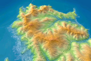
Use SkylineCloud’s computing resources to automate PhotoMesh 3D photogrammetry for optimized reconstruction at reduced costs.
Our services efficiently handle a wide range of data, from drone collections to aerial photography.
Fully automated service to run PhotoMesh projects, using REST API to manage the PhotoMesh production. Input data is read from and then pushed back to customer cloud storage (AWS/Google Cloud/Azure etc.). Output can also be published to SkylineCloud Hosting service.
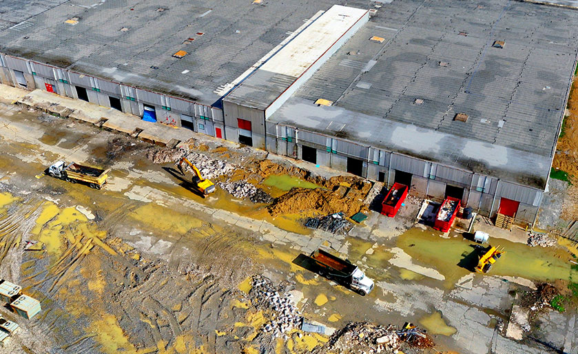
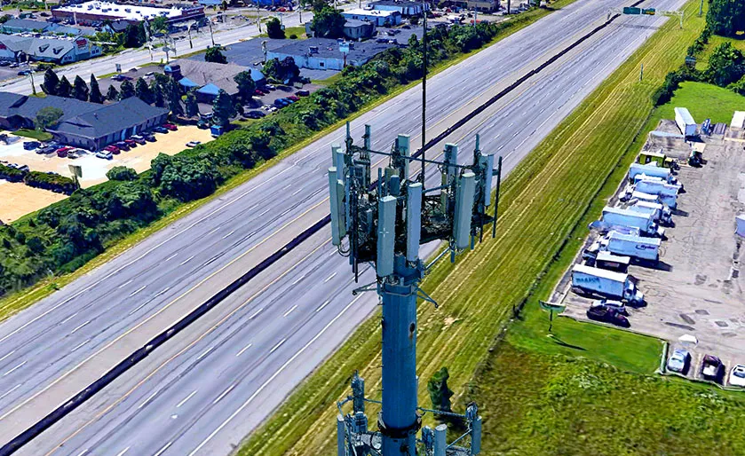
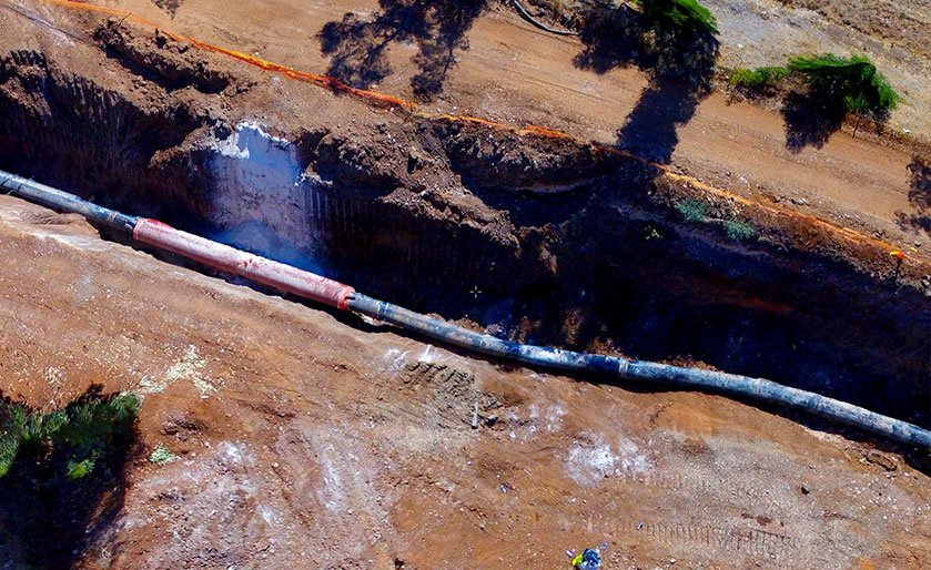
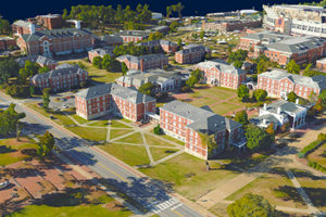
PhotoMesh 3D reconstruction service generates high resolution multi-band orthophotos, DSM/DTM, point clouds, and 3D mesh models that faithfully reproduce even small-scale details such as cars, trees, fences, and walls - all with advanced color balancing, edge and surface enhancement, and high-quality texturing. A wide range of output formats are supported including: GeoTIFF, 3DML, 3D Tiles, I3S/SLPK, LAS, and more...
Production capabilities are precisely matched to your processing requirements, ensuring rapid completion even for the most demanding projects. Regardless of project size, the necessary cloud resources—from a few machines to thousands—are allocated, guaranteeing completion within just a few hours.

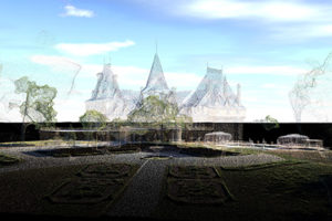
Unlock the potential of your drone and aerial data with our expert-driven, premium PhotoMesh processing services. Our state-of-the-art production facility and master photogrammetry services team guarantee the highest quality 3D Digital Twin and 2D True Ortho products.
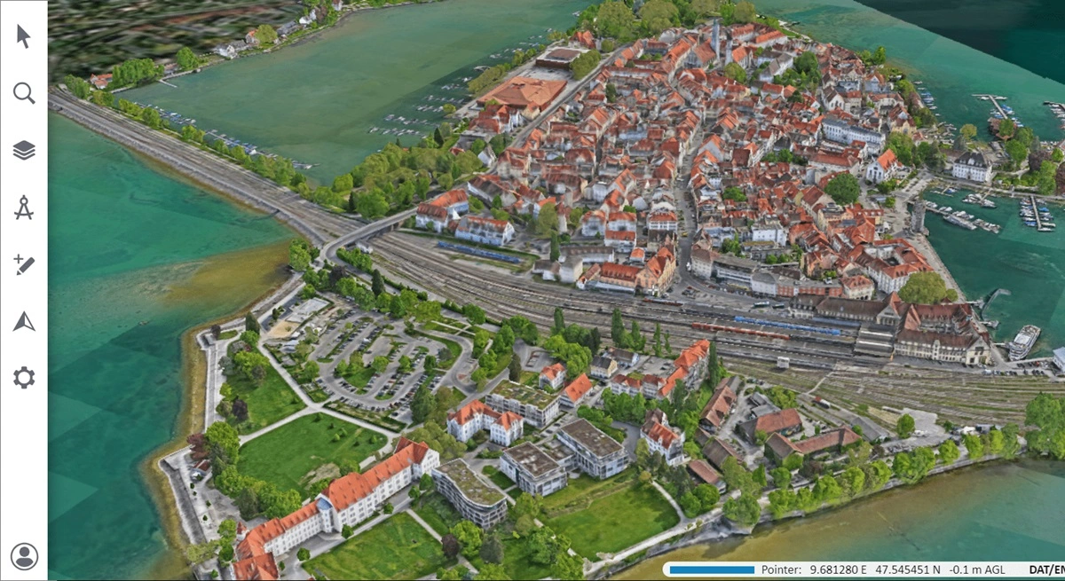
Featured Project: Lindau, Germany with fixed wing, drone capture of imagery & LiDAR / Processing Time: 3 days / Deliverables: 3D Textured Mesh &True Orthophoto at 2cm/pixel GSD
Our team excels at managing the most challenging reconstructions. Whether it involves massive-scale projects, unique camera systems, integration of photogrammetry with LiDAR, or combining aerial, drone, and terrestrial data—we handle it all. No project is too complex for us.
Ideal for anyone new to photogrammetry or embarking on new project types, partnering with Skyline for your initial venture ensures outstanding results and provides a template to streamline your future projects. This approach is particularly advantageous for surveyors and engineers looking to enhance their capabilities.
Our services focus on processing and reconstructing high-quality data, enabling you to concentrate solely on data capture. This division of labor is especially beneficial for aerial and drone service providers, ensuring each task is handled by specialists for optimal results.
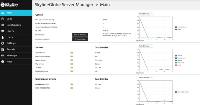
Enable uploading and sharing of geospatial data with range of 2D and 3D viewers using SkylineGlobe Server as a service

Customers can store masses of 2D and 3D geospatial data for their end users in a secure, access-controlled environment. Each customer has a private virtual site that completely isolates their users’ data and allows management/administration of the data layers and site users. Data can be accessed using user/password or token mechanisms.

SkylineCloud is built on top of the Amazon Web Services (AWS) infrastructure to provide reliable and fully scalable computing, storage and streaming resources. SkylineCloud offers global coverage using AWS’s Global Accelerator and smart caching mechanism to speed up streaming performance of 2D and 3D geospatial content.
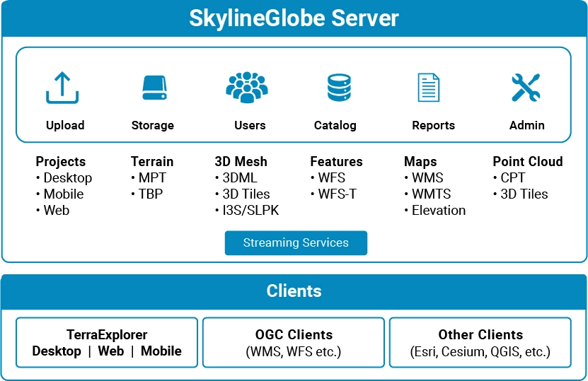
SkylineGlobe Server streams all 2D and 3D data needed to support complex TerraExplorer Desktop, web and mobile projects. Data includes all 3D mesh, imagery, elevation, and feature layers in stream-optimized formats, and all project resources published by TerraExplorer Pro. SkylineGlobe Server also provides powerful search tools and management and search capabilities.
Esri and the Esri Logo are licensed trademarks of Environmental Systems Research Institute, Inc.
SkylineGlobe Server streams data to Cesium, QGIS and other OGC clients in their native formats:
| Cookie | Duration | Description |
|---|---|---|
| cookielawinfo-checkbox-analytics | 11 months | This cookie is set by GDPR Cookie Consent plugin. The cookie is used to store the user consent for the cookies in the category "Analytics". |
| cookielawinfo-checkbox-functional | 11 months | The cookie is set by GDPR cookie consent to record the user consent for the cookies in the category "Functional". |
| cookielawinfo-checkbox-necessary | 11 months | This cookie is set by GDPR Cookie Consent plugin. The cookies is used to store the user consent for the cookies in the category "Necessary". |
| cookielawinfo-checkbox-others | 11 months | This cookie is set by GDPR Cookie Consent plugin. The cookie is used to store the user consent for the cookies in the category "Other. |
| cookielawinfo-checkbox-performance | 11 months | This cookie is set by GDPR Cookie Consent plugin. The cookie is used to store the user consent for the cookies in the category "Performance". |
| viewed_cookie_policy | 11 months | The cookie is set by the GDPR Cookie Consent plugin and is used to store whether or not user has consented to the use of cookies. It does not store any personal data. |