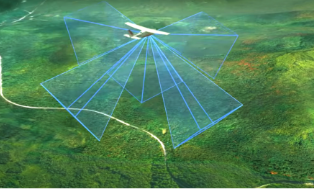
Using breakthrough 2D and 3D mapping technology, PhotoMesh generates highly-detailed 3D meshes, orthophotos, point clouds, elevation models, and more from standard photos in a wide range of formats.
TerraBuilder provides professional-grade tools for manipulating and merging aerial photos, satellite images, and digital elevation models into a photo-realistic, geographically accurate terrain database.
Fully automated service to run PhotoMesh projects can produce 2D, 3D and multi-spectral outputs. Dense point clouds with detailed color information, true orthophotos, and 3D mesh models can all be generated in a range of formats for maximum compatibility.
Share
Securely store, stream & access 3D geospatial data where, when, and how you need it.
The SkylineGlobe Server private cloud solution provides a comprehensive set of web services for publishing, storing, managing and streaming 2D and 3D geospatial content. All your GIS layer types are supported: 3D mesh , imagery, elevation, feature and point cloud.
Based on SkylineGlobe Server, SkylineCloud Hosting provides a fully managed service to upload, store, convert and stream nearly unlimited 2D and 3D spatial data. Data is kept secure with virtual private, geospatial servers, custom authentication, and user permissions.
Analyze
Powerful measurement, terrain analysis, line of sight, change detection/comparison and spatial analysis tools make it easy to extract vital intelligence from your geospatial data.
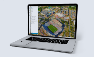
A cutting-edge 3D GIS desktop viewer and creator that provides powerful tools and a high resolution 3D environment in which to view, query, analyze and present geospatial data. Stunningly realistic 3D visualizations can be created by overlaying the terrain with unlimited data layers, 3D models, virtual objects and more.
Web-based 3D geospatial viewer that enables you to view and analyze high-resolution, realistic 3D content right in your web browser with no download or installation required. Web applications can be tailored to any customer needs.
Native mobile app based on TerraExplorer, TerraExplorer Mobile features advanced layer viewing and editing capabilities and selected measurement and analysis tools, as well as presentation and publishing options.
Fusing the power of augmented and virtual reality with our powerful 3D GIS visualization, modeling and analysis tools, Skyline has created a fully immersive and intuitive 3D geospatial exploration experience that fosters enhanced understanding and decision-making.
We use cookies on our website to give you the most relevant experience by remembering your preferences and repeat visits. By clicking “Accept”, you consent to the use of ALL the cookies.
This website uses cookies to improve your experience while you navigate through the website. Out of these, the cookies that are categorized as necessary are stored on your browser as they are essential for the working of basic functionalities of the website. We also use third-party cookies that help us analyze and understand how you use this website. These cookies will be stored in your browser only with your consent. You also have the option to opt-out of these cookies. But opting out of some of these cookies may affect your browsing experience.
Necessary cookies are absolutely essential for the website to function properly. These cookies ensure basic functionalities and security features of the website, anonymously.
Cookie
Duration
Description
cookielawinfo-checkbox-analytics
11 months
This cookie is set by GDPR Cookie Consent plugin. The cookie is used to store the user consent for the cookies in the category "Analytics".
cookielawinfo-checkbox-functional
11 months
The cookie is set by GDPR cookie consent to record the user consent for the cookies in the category "Functional".
cookielawinfo-checkbox-necessary
11 months
This cookie is set by GDPR Cookie Consent plugin. The cookies is used to store the user consent for the cookies in the category "Necessary".
cookielawinfo-checkbox-others
11 months
This cookie is set by GDPR Cookie Consent plugin. The cookie is used to store the user consent for the cookies in the category "Other.
cookielawinfo-checkbox-performance
11 months
This cookie is set by GDPR Cookie Consent plugin. The cookie is used to store the user consent for the cookies in the category "Performance".
viewed_cookie_policy
11 months
The cookie is set by the GDPR Cookie Consent plugin and is used to store whether or not user has consented to the use of cookies. It does not store any personal data.
Functional cookies help to perform certain functionalities like sharing the content of the website on social media platforms, collect feedbacks, and other third-party features.
Performance cookies are used to understand and analyze the key performance indexes of the website which helps in delivering a better user experience for the visitors.
Analytical cookies are used to understand how visitors interact with the website. These cookies help provide information on metrics the number of visitors, bounce rate, traffic source, etc.
Advertisement cookies are used to provide visitors with relevant ads and marketing campaigns. These cookies track visitors across websites and collect information to provide customized ads.