PhotoMesh – Fully automated, scalable photogrammetry
High-performance 3D reconstruction that transforms photos into quality, 2D and 3D geospatial data

Combining photos in a wide range of formats, PhotoMesh generates highly-detailed 3D meshes, orthophotos, point clouds, elevation models, and more. PhotoMesh’s breakthrough 2D and 3D mapping technology is based on the highest-performance photogrammetry, computer vision, and computational geometry algorithms.
PhotoMesh employs elaborate tiling mechanisms to efficiently handle projects of any size, even large projects with hundreds of thousands of photos. Running on standard hardware, PhotoMesh can also exploit computer clusters and cloud computing to vastly accelerate the build by running a single project simultaneously on hundreds of fuser machines.
Learn about PhotoMesh Drone: our powerful, single-computer solution for processing drone data.
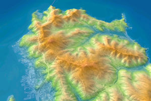
3D Mapping
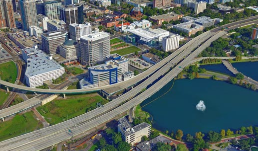
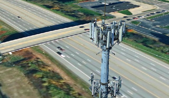
Digital Twin
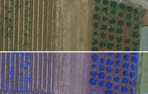
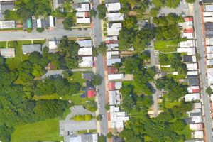
2D Mapping
High Quality
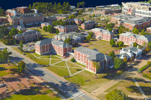
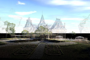
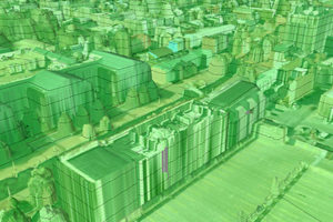
PhotoMesh generates a full-3D mesh model that faithfully reproduces even small-scale details such as cars, trees, fences, and walls - all with advanced color balancing and high-quality texturing.
Production Automation
Robust REST APIs allow developers to create, monitor, and manage project queues and to automate PhotoMesh production flows on local machines, remote servers, and the cloud.
Scalability
PhotoMesh efficiently handles even hundreds of thousands of photos using an elaborate tiling mechanism. PhotoMesh exploits multi-computer architecture (fusers) to further accelerate database creation, running a single project simultaneously on hundreds of machines.
High Performance
PhotoMesh can run its efficient algorithms fluidly on standard GPUs, or exploit multi-core and multi-computer processing to further accelerate database creation. A single project can run simultaneously on hundreds of fuser machines, processing tens of km2 per day.
Cloud Ready
PhotoMesh can exploit computer clusters and cloud computing to run a single project simultaneously on hundreds of fuser machines. Sharing the workload involved in generating PhotoMesh output vastly accelerates the build process.
Usability
Intuitive GUI and powerful, versatile tools for accurate evaluation and adjustment of your input data and AT, including: a coverage map, photo inter-connection map, Lidar data integration, control points, photo projection on terrain and Lidar and much more.
PhotoMesh makes it easy to combine data of a variety of formats and sources
- Standard image formats (Jpg, Tiff…)
- Photos with hyperspectral bands (NIR)
- Phase One IIQ
- AT packages - Bingo, Inpho, VisionMap, Stellacore…
- Video files (most formats)
- LIDAR (LAS, E57)
- Photo list files
Range of supported output formats ensures maximum interoperability with other 2D/3D GIS solutions
3D Mesh
Point Cloud
Orthophoto
Digital Surface Model (DSM)