Products & Services
PhotoMesh
Fully-automated, scalable photogrammetry High-performance 3D reconstruction that transforms photos into quality, 2D and 3D geospatial data
Combining photos in a wide range of formats, PhotoMesh generates highly-detailed 3D meshes, orthophotos, point clouds, elevation models, and more. PhotoMesh’s breakthrough 2D and 3D mapping technology is based on the highest-performance photogrammetry, computer vision, and computational geometry algorithms.

TerraBuilder
High-performance terrain database creator
TerraBuilder provides professional-grade tools for manipulating and merging aerial photos, satellite images, and digital elevation models of different sizes and resolutions. The resulting photo-realistic, geographically accurate terrain database can be made available to local TerraExplorer clients or published directly from TerraBuilder to SkylineGlobe Server for serving to remote TerraExplorer and WMS/WMTS clients.
SkylineGlobe Server
Securely store & access 3D geospatial data where, when, and how you need it
The SkylineGlobe Server private cloud solution provides a comprehensive set of web services for publishing, storing, managing and streaming 2D and 3D geospatial content. All your GIS layer types are supported: 3D mesh, imagery, elevation, feature and point cloud. SkylineGlobe Server makes it easy for you to share your data by converting and exposing your content in multiple formats, while storing only the original data formats on the server.
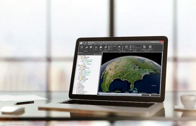
TerraExplorer for Desktop
Create, view, analyze & share high-resolution 3D geospatial data
A cutting-edge 3D GIS desktop viewer and creator that provides powerful tools and a high-resolution 3D environment in which to view, query, analyze and present geospatial data. With TerraExplorer’s robust and extensive capabilities and ever-increasing interoperability, stunningly realistic 3D visualizations can be created by overlaying the terrain with unlimited data layers, 3D models, virtual objects and more.
TerraExplorer for Web
Explore and analyze high-resolution 3D geospatial data
TerraExplorer for Web is a lightweight 3D GIS viewer that enables you to view and analyze high- resolution, stunningly realistic 3D content in your web browser. The employment of HTML5/ WebGL standards allows TerraExplorer for Web to provide support for multiple platforms and browsers. Built on the powerful Cesium open source library, TerraExplorer for Web further extends the core functionality with additional capabilities and enhanced performance.


TerraExplorer for Mobile
Visualize and analyze data, any time, any place
TerraExplorer for Mobile is a powerful 3D GIS viewer for Android & Apple iOS devices based on TerraExplorer for Web, that offers the functionality of the web app in a mobile-optimized GUI. TerraExplorer for Mobile can display most of your spatial databases including 3D city layers and feature layers, and it provides powerful tools to query, analyze and present your data on the go.
SkylineCloud Services
Skyline’s Software as a Service (SaaS) offers computing, storage and streaming services tailored to your needs
SkylineCloud provides a set of software, production, infrastructure, data and billing services to help you optimize your 2D and 3D geospatial data production and hosting. With SkylineCloud, users can easily subscribe to packages that include all or parts of these services to start enjoying the Skyline suite of products. SkylineCloud is built on top of the Amazon Web Services (AWS) infrastructure to provide reliable and fully scalable computing, storage and streaming resources.


Advanced 3D Visualization Solutions
Connect between real-world experiences and digital content for enhanced decision making
Our advanced 3D visualization solutions fuse the power of augmented and virtual reality with our powerful 3D GIS visualization, modeling and analysis tools, to create a fully immersive and intuitive 3D geospatial exploration experience. Skyline’s solutions transform your raw data into precise, actionable information, empowering you to quickly make decisions and act based on deep analysis of high-quality and real-time intelligence.