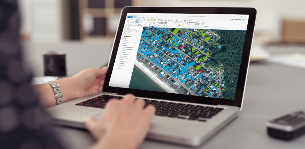
TerraExplorer for Desktop
Create, view, analyze & share high-resolution 2D & 3D geospatial data
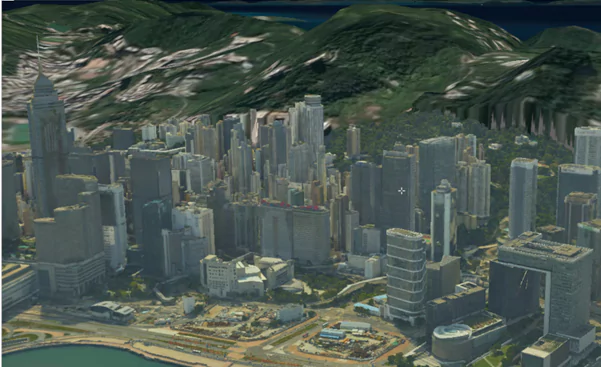
A cutting-edge 3D GIS desktop viewer and creator that provides powerful tools and a high resolution 3D environment in which to view, query, analyze and present geospatial data. With TerraExplorer’s robust and extensive capabilities and ever-increasing interoperability, stunningly realistic 3D visualizations can be created by overlaying the terrain with unlimited data layers, 3D models, virtual objects and more.
Visualize
Analyze
Create
Inspect
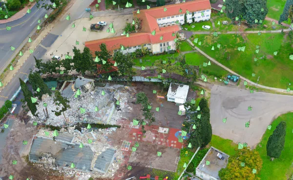
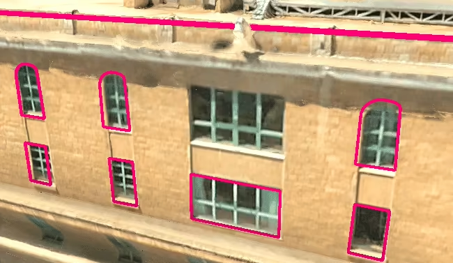
View and inspect your PhotoMesh 3D models (tower, bridge, construction site, etc.) from within TerraExplorer, together with the source photos used to produce them. You can also create inspection feature layers in which you mark and measure areas (e.g., that require retouching) in your 3D model or on photos in the Photo Inspector.
Use With Your Existing Technology
TerraExplorer is designed with interoperability and flexibility at its core, allowing you to build and share geospatial projects quickly and easily. TerraExplorer supports a wide range of read and write formats including:
- Imagery and elevation layers in OGC WMS/WMTS, Tiff, JPEG, MrSID, ECW, IMG…
- 3D mesh layers in 3DML, 3D Tiles, OSGB and I3S/SLPK
- Feature layers in OGC WFS/WFS-T, Shapefile, KML, SQLite, GeoPackage, ArcGIS Server, Oracle database and other local and online
- CAD in DWG or DXF; BIM in FBX or IFC
- Point cloud layers in LAS/LAZ
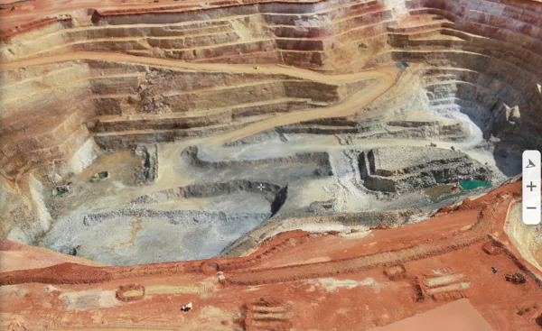
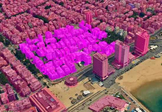
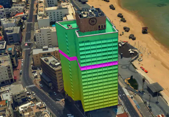
Analyze the 3D World
Increase understanding and improve decision making with a complete set of powerful tools for all forms of 3D World measurement and analysis
- Distance
- Flood
- Terrain Profile
- Line of Sight
- Area
- Volume
- Shadow Queries
- Viewshed
- Contour
- Mesh Comparison
- Cross Section
- Viewshed on Route
- Slope
- Image Comparison
- Elevation Difference
- Threat Dome
Share Your Data
Easily share your 3D visualizations by creating presentations with customized flight routes and exporting them to video files. Use the Collaboration tool for remotely guided tours. View your complex 3D content by stereo monitors or VR devices and publish and extract projects to web, desktop, and mobile devices.
Query and Editing Tools
Create smart cities that integrate massive amounts of digital data in one platform to optimize design and planning and ongoing operation of assets. Integrating feature layers with survey-grade, geo-referenced mesh and point cloud layers allows you to digitize the 3D world to generate highly accurate 3D layers. Robust feature layer viewing and editing is supported, including geometry editing, spatial queries, addition and deletion of features, attribute-based styling, and spatial operations such as merging, clipping and exploding features and exporting of selected features to a new file.
Advanced Drawing Tools
Versatile and configurable drawing tools bring to life your 3D GIS visualizations and simulations, with roads, traffic lights, powerlines, pipelines, fences, walls, and more. Advanced particle system engine enables you to create vibrant visual effects that realistically simulate weather elements, light effects, water effects, or smoke and fire. Powerful mesh editing tools allow you to examine the photos used to create a mesh and mark mesh imperfections for implementation in PhotoMesh.
TerraExplorer for Developers
TerraExplorer’s rich application programming interface (API) allows you to easily develop powerful, customized 3D desktop, Web, and mobile applications or integrate TerraExplorer capabilities in OEM applications. All of the interfaces, based on the COM protocol, can be managed through a scripting language (e.g., JavaScript) as well as non-scripting languages (e.g., C++ or C#).

TerraExplorer Desktop is available in three versions, offering increasing levels of functionality
TerraExplorer Viewer
Users can navigate through and perform advanced terrain analysis and basic editing of high resolution 3D world environments created by fusing aerial and satellite photography, terrain elevation data and other 2D and 3D information layers.
TerraExplorer Plus
Adds loading of all 2D and 3D offline formats, feature layer editing and querying, advanced objects and drawing tools, a set of tools for professional usage, multi-user collaborative sessions, and the advanced Pro API interfaces.
TerraExplorer Pro
Adds publishing capabilities, conversion tools, optimization of model files for improved display performance, and uploading of data to SkylineGlobe cloud.