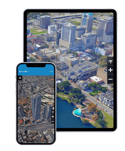


Visualize and analyze data, any time, any place
TerraExplorer for Mobile is a powerful 3D GIS viewer for Android & Apple iOS devices based on TerraExplorer for Web, that offers the functionality of the web app in a mobile-optimized GUI. TerraExplorer for Mobile can display most of your spatial databases including 3D city layers and feature layers, and it provides powerful tools to query, analyze and present your data on the go.
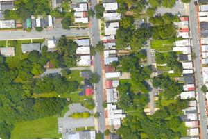
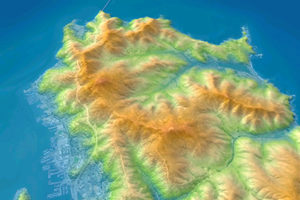
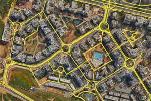
View terrain overlaid with imagery and elevation, 3D mesh, BIM, CAD, Lidar point cloud, and feature (vector) layers. Use TerraExplorer for Mobile and the rest of the SkylineGlobe 3D platform to share geoportals with advanced visual and graphical information that improves understanding and allows agencies and constituents to collaborate in the decision making process.
Robust measurement, terrain analysis, and line of sight tools make it easy to extract vital intelligence from your geospatial data. This drives smarter decisions in mission planning, urban planning, inspection, and more…
TerraExplorer for Mobile leverages broad compatibility with Android and iOS devices for convenient on-the-go access from smartphones and tablets.
3D Mesh
Point Cloud
Imagery
Elevation
Features
Zoom in and search the 3D World to gain new perspective. Increase understanding and improve decision making with a set of powerful tools for 3D World measurement and analysis.
The TerraExplorer mobile app integrates smoothly with the entire Skyline product line for easy access to all your data – from photo-realistic, geographically accurate terrain databases created in TerraBuilder to PhotoMesh’s high-resolution, textured, 3D mesh models. Consume data that was created and directly published from TerraExplorer Pro – as is. No additional programming or processing is needed to load a project or layer.
Layer access can easily be restricted to the users, groups, and sites that you want, by setting the desired view and access in SkylineGlobe Server. Users will only see and be able to load from SkylineGlobe Server the layers that are available to them, based on their login.
Utilizing the TerraExplorer for Mobile (TE4M) app as a foundation, you can leverage the application framework and functionality, thus reducing the amount of programming required for your customized solution: create custom configurations, localize GUI texts, and customize and expand TE4M capabilities, using TerraExplorer for Web and its underlying Cesium API.
3D GIS viewer for Android & Apple iOS devices based on TerraExplorer for Web, that offers the functionality of the web app in a mobile-optimized GUI.
Powerful 3D geospatial web viewer for exploring, analyzing, and editing high-resolution, stunningly realistic 3D content right in your web browser.
A cutting-edge 3D GIS desktop viewer and creator that provides powerful tools and a high resolution 3D environment in which to view, query, analyze and present geospatial data.
Our user-friendly, mobile optimized user interface makes it easy to explore and analyze your 3D World, anywhere, anytime. TerraExplorer for Mobile supports touch gestures for easy navigation such as zoom, pan, rotate, and tilt.
| Cookie | Duration | Description |
|---|---|---|
| cookielawinfo-checkbox-analytics | 11 months | This cookie is set by GDPR Cookie Consent plugin. The cookie is used to store the user consent for the cookies in the category "Analytics". |
| cookielawinfo-checkbox-functional | 11 months | The cookie is set by GDPR cookie consent to record the user consent for the cookies in the category "Functional". |
| cookielawinfo-checkbox-necessary | 11 months | This cookie is set by GDPR Cookie Consent plugin. The cookies is used to store the user consent for the cookies in the category "Necessary". |
| cookielawinfo-checkbox-others | 11 months | This cookie is set by GDPR Cookie Consent plugin. The cookie is used to store the user consent for the cookies in the category "Other. |
| cookielawinfo-checkbox-performance | 11 months | This cookie is set by GDPR Cookie Consent plugin. The cookie is used to store the user consent for the cookies in the category "Performance". |
| viewed_cookie_policy | 11 months | The cookie is set by the GDPR Cookie Consent plugin and is used to store whether or not user has consented to the use of cookies. It does not store any personal data. |
For security purposes, please solve this simple puzzle to verify you are human before sending an OTP.