
Key Takeaways
- A geospatial digital twin combines location, 3D context, operational data, and workflows to provide a practical foundation for real-world decision-making.
- The foundation is reliable 3D spatial data, including terrain, imagery, mesh, point clouds, elevation, features, and asset layers.
- The best implementations prioritize data accuracy, source traceability, security, access control, and integration with enterprise systems.
- Operational value grows when the twin connects to live feeds, alerts, field updates, and planning tools.
- Skyline solutions such as TerraExplorer Fusion and SkylineGlobe Server support visualization, streaming, publishing, analysis, and collaboration across 3D environments.
Digital twins are becoming a practical tool for teams that need to understand, manage, and respond to complex real-world environments. For cities, infrastructure owners, emergency agencies, and defense organizations, the value lies not only in a realistic 3D scene, but in connecting accurate location, operational context, live information, and decision workflows in one trusted environment.
A geospatial twin helps teams answer questions that are difficult to solve with flat maps or isolated models: What assets are affected by an incident? Which routes are still accessible? Where is risk increasing? When the twin is built well, it becomes a shared operating picture that supports planning before an event and action during one.
For organizations that already manage imagery, elevation, point clouds, BIM, CAD, sensor feeds, and field observations, the challenge is building a governed system that can keep pace with real operations.
What Is a Geospatial Digital Twin?
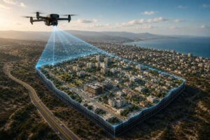
A geospatial digital twin is a virtual representation of a physical place, system, or operational area grounded in a real-world location. Unlike a general 3D model, it represents more than geometry and appearance. It also brings together the position, attributes, relationships, history, and current status of real assets and environments.
For infrastructure teams, that can mean combining roads, tunnels, power corridors, drainage systems, buildings, and public works assets into a navigable 3D environment. For defense and intelligence users, it can mean understanding terrain, visibility, access routes, protected areas, sensor placement, and mission constraints. For urban planners, it can mean evaluating development, mobility, environmental exposure, and public safety impacts in context.
The common thread is location. A useful twin reflects where things are, how they relate to one another, and what changes over time. It may include high-resolution 3D mesh, orthophotos, elevation models, LiDAR point clouds, feature layers, BIM data, CAD drawings, inspection records, sensor alerts, and operational annotations. When these sources are aligned correctly, the twin becomes a reliable environment for testing scenarios and coordinating decisions.
This is why visualization alone is not enough. A realistic 3D city, campus, base, airport, or utility corridor is helpful, but teams also need searchable layers, measurable geometry, controlled access, metadata, system integration, and update workflows.
How Is a Geospatial Digital Twin Built?
Most twins follow the same production pipeline: capture, processing, publishing, and continuous update. Capture may combine aerial photography, imagery captured for drone 3D mapping, LiDAR, satellite data, and existing GIS, BIM, and CAD records. The mix depends on the required accuracy, coverage area, and refresh frequency.
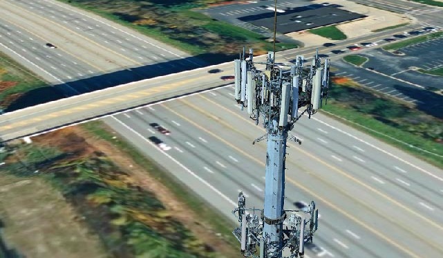
Photogrammetric processing turns that raw material into the 3D foundation. Skyline’s PhotoMesh converts large collections of overlapping aerial and drone imagery into city-scale 3D mesh, orthophotos, elevation models, and point clouds, with quality controls that preserve the accuracy and traceability the twin depends on.
Tools such as TerraBuilder create the base terrain from elevation and imagery sources, while TerraExplorer brings the terrain, mesh, and operational layers together and publishes them to SkylineGlobe Server, where the content is streamed, catalogued, secured, and connected to operational data. Organizations that prefer not to manage production internally can engage Skyline Production and Hosting Services or on-demand services such as NEXUS to deliver twin-ready content.
Geospatial Digital Twin Best Practices
The quality of the final environment depends heavily on the discipline used to build it. Strong geospatial modelling starts with clear objectives: what decisions the twin must support, what accuracy is required, which users need access, and which systems must connect.
Start with trusted source data. Imagery, terrain, mesh, point clouds, GIS features, BIM, and CAD files should be documented with collection date, coordinate reference system, resolution, processing method, and ownership. Teams should know whether they are looking at current survey-grade information, archive imagery, design data, or a planning assumption.
Preserve traceability. Every layer should have a source, timestamp, and responsible owner. This is especially important for emergency response, defence planning, engineering decisions, or public infrastructure investment. If a user cannot tell where a layer came from or when it was updated, confidence drops quickly.
Build for integration. A twin is most useful when it connects with the systems teams already use: GIS databases, asset management systems, real-time sensors, work order tools, command-and-control systems, weather feeds, video, or field reporting applications. The chosen digital twin platform should support standards, APIs, streaming, secure publishing, and role-based access. Because every Skyline product provides an API, each stage of the pipeline can be automated, from production and publishing through to ongoing updates. Custom tools can also bring in data from external services as the twin evolves.
Use the right hosting and streaming model. Large 3D environments can be data-intensive. Efficient delivery requires optimized formats, server-side cataloging, permission controls, and clients that can stream only what users need. SkylineGlobe Server is designed to publish, manage, store, and stream 2D and 3D geospatial content to TerraExplorer clients and other GIS applications.
Keep the environment current. A twin that is not maintained becomes a historical model. Establish update cycles, define approval workflows for edits, and make sure operational layers can be refreshed as field conditions change. Some projects can rely on archive-based production; others require new aerial collection, mobile mapping, drone surveys, or sensor integration.
Skyline’s NEXUS on-demand production service is a good example of how production, imagery sourcing, and scalable delivery can be packaged for organizations that need accurate 3D environments without managing every processing step internally.
How Geospatial Digital Twins Connect to Real-Time Decision-Making
The biggest shift happens when the twin moves from planning reference to operational environment. In real-time decision-making, teams are not only asking what an area looks like. They are asking what is happening, who is affected, which actions are available, and what the likely outcome will be.
During incident response, a 3D operational environment can help teams evaluate access routes, staging areas, line of sight, building proximity, evacuation zones, and critical infrastructure exposure. If live information is available, responders can combine field reports, sensor alerts, traffic restrictions, weather, and updated imagery in the same spatial context.
For mission planning, terrain and urban context matter. Analysts may need to review visibility, approach routes, elevation, restricted zones, asset locations, communications coverage, or obstacles. A shared 3D environment allows stakeholders to plan from the same reference instead of separate files or screenshots.
For city planning and infrastructure management, frequently updated twins support better coordination across departments. A road closure can be reviewed against transit, utilities, emergency access, construction activity, and public facilities. A flood scenario can be analyzed against elevation, drainage assets, population centers, and response routes.
Tools such as TerraExplorer Fusion help users explore, analyze, and measure high-resolution 3D content in a web browser. TerraExplorer Fusion Plus also supports feature-layer editing, while server-side publishing and cataloging make data available to the right people.
The most successful projects usually begin with a defined use case rather than a technology-first mandate. A team may start with emergency planning for a venue, inspection workflows for a utility corridor, situational awareness for a defense installation, or development review for a city district. Once the first workflow proves value, the same foundation can expand to additional departments, datasets, and operational scenarios.
Ready to Build Your Geospatial Digital Twin?
Whether you are starting with a single site or planning a city-scale environment, the right foundation makes the difference between a static model and a living operational tool. Explore how Skyline Software Systems can help you capture, publish, stream, and analyse high-resolution 3D environments, or contact the team to discuss your use case and request a demo.
FAQ
How is a geospatial digital twin different from a standard 3D model?
A standard 3D model usually represents shape, texture, and appearance at a point in time. A location-based twin adds spatial accuracy, attributes, source metadata, operational layers, and update workflows. It can support measurement, analysis, access control, and integration with live or frequently refreshed data, making it useful for decisions rather than visualization alone.
What data sources are used to build a geospatial digital twin?
Common sources include aerial imagery, satellite imagery, drone photography, LiDAR, point clouds, terrain and elevation models, GIS feature layers, BIM, CAD, sensor feeds, inspection records, and field reports. The right mix depends on the use case. Emergency response, defense planning, utility management, and urban development each require different levels of accuracy, refresh frequency, and operational detail.
What industries benefit most from geospatial digital twins?
The strongest benefits are often seen in infrastructure, defense, emergency response, utilities, transportation, city planning, construction, and large facility management. These sectors depend on location, asset relationships, and changing field conditions. A shared 3D operating environment helps teams coordinate work, reduce uncertainty, plan scenarios, and respond faster when conditions change.
How much does it cost to build a geospatial digital twin?
Cost depends on coverage area, required resolution and accuracy, capture method, data you already own, and how often the twin must be refreshed. A single site using existing imagery will typically cost less than a city-scale program with recurring aerial capture. Defining the decisions the twin must support first keeps scope and budget under control.
Ready to Build Your Geospatial Digital Twin?
Whether you are starting with a single site or planning a city-scale environment, the right foundation makes the difference between a static model and a living operational tool. Explore how Skyline Software Systems can help you capture, publish, stream, and analyze high-resolution 3D environments, or contact the team to discuss your use case and request a demo.