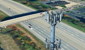


Infrastructure operators face increasing pressure to inspect, maintain, and modernize large networks of assets while minimizing costs and operational disruptions. Whether managing telecommunications towers, power transmission lines, highways, rail corridors, or other critical infrastructure, organizations need accurate and up-to-date information to support maintenance, planning, and decision-making.
This demand has driven rapid adoption of 3D mapping services, transforming drone, mobile mapping, aerial imagery, and LiDAR data into digital twins that support inspection, asset management, change detection, and construction progress monitoring, enabling organizations to compare planned designs with actual field conditions and track project execution over time.
However, not all 3D mapping services are created equal. While many providers can generate visually impressive models, infrastructure projects require much more than attractive imagery. The quality of the reconstruction, the reliability of production workflows, the scalability of processing, and the ability to support inspection and analysis workflows are often what determine long-term project success.
This guide outlines the key factors organizations should evaluate when selecting a 3D mapping service for infrastructure monitoring and inspection projects.
Key Takeaways
- Infrastructure projects require more than a visually attractive 3D model. Reliability, scalability, and inspection capabilities are equally important.
- The ability to consistently process imperfect drone and mobile mapping data often determines project success.
- Long-term infrastructure monitoring depends on accurate alignment between multiple surveys collected over time.
- Modern workflows should support multiple output types, includingה. mesh models, point clouds, and emerging technologies such as Gaussian Splatting.
- The best 3D mapping services combine high-quality production with tools for asset management, inspection, and change detection.
What 3D Mapping Services Cover for Infrastructure Monitoring
3D mapping services convert drone, mobile mapping, aerial, and LiDAR captures into inspection-ready digital twins of physical assets. Output formats vary by workflow:
- Photorealistic mesh models for navigation and visual inspection
- Point clouds for engineering, survey, and measurement work
- Gaussian Splatting models for thin and complex structures
- Orthophotos for planimetric mapping and documentation
- Elevation models for terrain, drainage, and clearance analysis
Each representation answers a different question. Point clouds preserve measured sensor data for engineering teams, while mesh models dominate infrastructure digital twins because they stream lightly and navigate easily. Gaussian Splatting, published by Inria and the Max Planck Institute in 2023, renders thin geometry with detailed traditional meshing struggles to match, which makes it worth tracking for poles, wires, and antenna arrays.
Scope matters as much as output. Some teams already run aerial survey software in-house and want production capacity alone. Others want the full chain: production, hosting, streaming, visualization, and analysis under one roof. Settle which of the two you are buying before comparing vendors, because the shortlists barely overlap.
Why Infrastructure Projects Need Reliable 3D Mapping
Digital twin programs earn their budget by removing trips to the field and moving inspection to a desk. The operational drivers infrastructure teams report:
- Fewer truck rolls and climbs per cycle, where most of the hard cost sits
- Lower crew exposure on work at height or near energized lines
- Remote review across engineering, operations, and maintenance without a site visit
- A time-series record supporting AI-assisted defect detection and predictive maintenance
- Network-wide capital planning built on condition data covering every asset
The regulatory picture is moving the same way. The FAA published its proposed beyond visual line of sight rule in the Federal Register on August 7, 2025, and it remains a proposal rather than a final rule. Once BVLOS operations become routine, the volume of imagery arriving from the field climbs sharply and the bottleneck moves from collection to processing.
How to Choose a 3D Mapping Service: Key Criteria
Reconstruction Quality and Accuracy
The first consideration is naturally the quality of the generated 3D model.
For infrastructure inspection projects, quality should be evaluated based on how accurately the model represents critical assets rather than simply how visually attractive it appears. Telecommunication towers, transmission structures, utility poles, antennas, insulators, transformers, and bridge components often contain complex and thin features that are traditionally challenging to reconstruct.
Organizations should request sample projects similar to their operational environments and examine:
- Representation of thin structures and wires
- Detail quality around equipment and attachments
- Surface completeness
- Texture quality
- Accuracy of measurements and geometric relationships
High-quality models improve inspection effectiveness and reduce the need for repeated site visits.
Reliability and Project Success Rate
Reliability is often more important than raw model quality.
In reality, field-collected data is rarely perfect. Drone missions may suffer from difficult lighting conditions, challenging weather, incomplete overlap, vegetation interference, or GPS limitations. The true test of a provider is how consistently they can process real-world datasets and deliver successful results.
Organizations should evaluate:
- Success rates across different project types
- Automated recovery mechanisms
- Handling of difficult environments
- Consistency of results across multiple collections
Reliable automated processing workflows help reduce delays, lower operational costs, and improve project success rates.
Processing Capacity at Enterprise Volume
A pilot project consisting of a few towers is fundamentally different from an operational program processing thousands of assets annually.
Many telecommunications and utility organizations require:
- Large-scale automated production
- Centralized project management
- High-volume processing capacity
- Consistent quality across projects
Organizations managing extensive transmission networks, telecommunications infrastructure, roads, or railways should evaluate whether a provider can scale effectively without introducing bottlenecks or excessive manual processing.
Scalability becomes particularly important when digital twin programs expand from small pilots into enterprise-wide operations.
PhotoMesh distributes reconstruction across a fuser cluster, so capacity grows by adding machines rather than by buying processing credits.
Temporal Alignment and Change Detection
Infrastructure monitoring is typically an ongoing process rather than a one-time activity.
Organizations often need to compare surveys collected over months or years to identify changes in asset condition, vegetation growth, construction progress, or structural deterioration.
This requires more than accurate positioning of individual projects. It requires consistent alignment between projects.
Providers should demonstrate how they:
- Align repeated surveys
- Support change detection workflows
- Handle temporal comparisons
- Minimize positional drift between datasets
For many inspection programs, consistent alignment between surveys can be more valuable than achieving the highest possible absolute positional accuracy.
Inspection and Asset Management Capabilities
A 3D model alone provides limited value. The real benefit comes from enabling organizations to inspect, manage, and analyze infrastructure assets.
Key capabilities should include:
- AI-assisted asset identification
- Asset inventory management
- Condition monitoring
- Defect documentation
- Maintenance planning
- Inspection reporting
For telecommunications and power utility projects, these tools can help identify and manage:
- Towers
- Poles
- Antennas
- Communication equipment
- Insulators
- Conductors
- Transformers
- Associated infrastructure assets
Modern inspection platforms increasingly incorporate AI technologies that assist inspectors in identifying missing components, corrosion, vegetation encroachment, cracks, and other potential issues.
EPRI curated roughly 7,000 labeled transmission images for its automated inspection research, targeting more than 100,000, which suggests the volume behind models that perform reliably.
Support for Mesh, Point Cloud, and Gaussian Splatting Workflows
Infrastructure organizations are increasingly evaluating different methods of representing reality-capture data.
Point clouds remain widely used for engineering and surveying workflows because they preserve measured spatial information directly from sensors. Mesh models continue to be the dominant format for infrastructure digital twins because they provide a realistic and easy-to-navigate representation of the environment.
Gaussian Splatting is an emerging technology attracting significant attention due to its ability to represent complex and thin structures with exceptional visual detail. This makes it particularly interesting for applications involving utility poles, transmission towers, wires, and communications infrastructure.
Organizations selecting a 3D mapping service should look for providers that support multiple output formats rather than locking projects into a single technology. This flexibility protects long-term investments and allows future workflows to evolve as technology matures.
Delivery, Hosting, and Integration
The final deliverable is often just as important as the production process itself.
Infrastructure teams need secure and efficient access to their digital twins across engineering, operations, maintenance, and management departments.
Organizations should evaluate:
- Cloud and on-premises deployment options
- GIS integration capabilities
- Enterprise security requirements
- Data-sharing workflows
- Support for large datasets
- API and third-party integrations
Some providers focus exclusively on model production, while others offer complete platforms supporting hosting, visualization, analysis, and inspection workflows.
Skyline Software Systems covers both ends of the chain, producing digital twins as a managed service and licensing the stack behind them, from PhotoMesh through to advanced 3D visualization for inspection and analysis.
FAQ
How accurate does a 3D mapping service need to be for infrastructure monitoring?
Accuracy requirements depend on the job. Asset inventory, engineering design, and utility network management usually need survey-grade positioning from RTK, PPK, or ground control points. Routine condition monitoring needs something different: repeat surveys aligned tightly to each other, even where the project carries a small shared offset from absolute coordinates. Ask providers to demonstrate both before committing.
Can 3D mapping services work with data we have already captured?
Yes, in most cases. Providers can process existing drone imagery, mobile mapping runs, aerial photography, and LiDAR collections, and many organizations start exactly this way. Final quality depends on the coverage and quality of the original capture, though modern pipelines recover from uneven overlap, mixed image quality, and difficult light. Confirm the provider supports your sensors and file formats first.
How long does it take to get inspection-ready 3D models from raw aerial data?
Turnaround depends on dataset size, capture quality, and whether the provider runs a shared queue or dedicated capacity. A single tower or substation typically returns within a day, while corridor and network-scale projects run longer. Ask for turnaround on a dataset matching your own volume, and what happens to that figure during a seasonal peak.
Choosing a Partner for the Long Term
Selecting a 3D mapping service is a decision about the next five years of your program, not about a single deliverable. Weigh success rate on messy data, capacity at your real annual volume, alignment across repeat surveys, and the tooling your inspectors will open every week. Then run the evaluation on your own data, because demo datasets flatter everyone.
Explore Skyline’s mapping and surveying solutions to see how production, hosting, and inspection fit together.